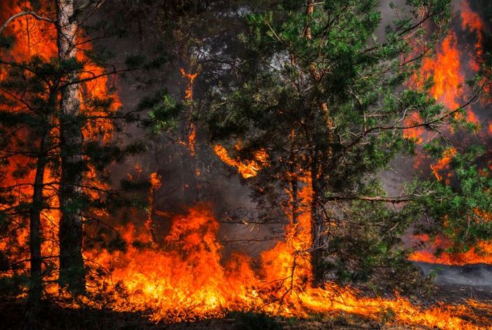
Geoves

Geoves


Instrumentation manufacturers for environmental monitoring
Menu
  • Home
  • About us
  • Products
      • Dataloggers
      • Software
      • Meteorological sensors
      • Hydrological sensors
      • Air quality sensors and special
      • Accessories for sensors
  • Contacts
  • Applications
  • Services
      • Repair authorization request
  • News
  • Data area
  • Italiano (IT)
  • English (UK)
  • You are here:  
  • Home
  • Applications
  • Forest fire alarm

Forest fire alarm

  • Stazione meteo per incendi boschivi


Main applications

1. Monitoring and prevention of forest and forest fires
2. Multi-point environmental monitoring


More information

Richiedi info preventivo  Photo Gallery  Richiedi info preventivo Info / Quote request


  • Description
  • Specifications
  • Accessories
  • Download PDF
  • Description
  • Specifications
  • Accessories
  • Download PDF

Description

MAIN FEATURES

In the monitoring network the functional elements are:

1. A series of wireless multi-parameter sensors mod. B-Sentinel located at strategic points in the wooded area to alert the on-call personnel and the operations centre in real time
2. A server with web software for monitoring the network and collecting and processing data
3. One or more web cameras to verify the presence of smoke/fire in the wooded area
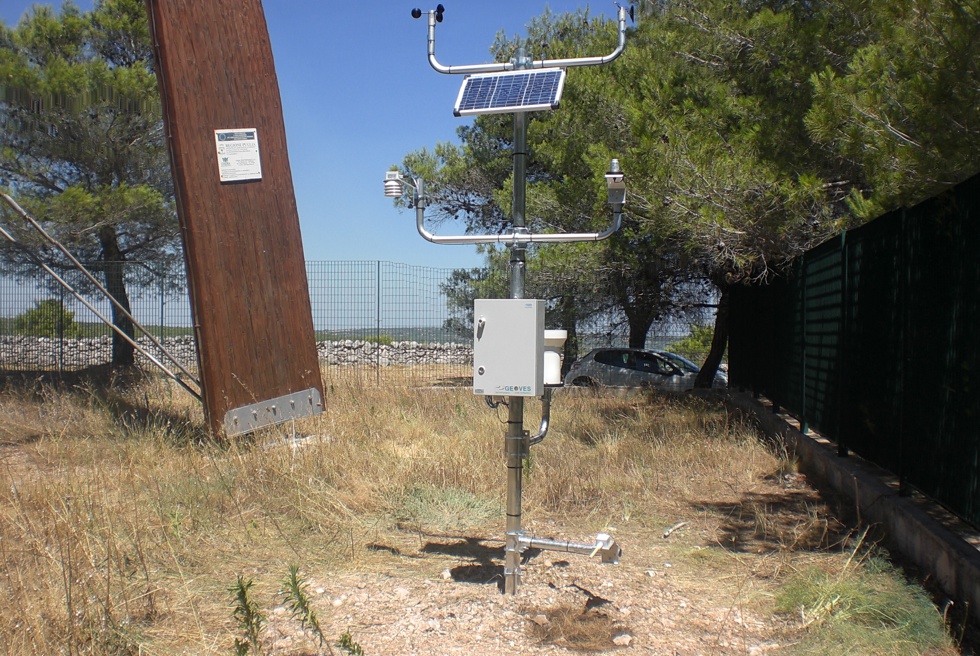
4. A weather station mod. MicroMET for measuring environmental conditions
5. A communication system on a 2G-4G cellular network with data sending to an FTP area and alarms via SMS

The operating logic of the individual functional elements of the network listed above is described below.


Layout of the forest fire monitoring and warning system


1. Woking logic of B-Sentinel smart sensors

B-Sentinel has an operating logic managed by a microprocessor that allows you to configure both the data storage and transmission rate and the alarm thresholds of all connected measurements.

Each individual B-Sentinel independently acquires the instantaneous data of the connected sensors and verifies that the CO2 value is lower than the set threshold value (the value is always checked every 5 minutes to allow the CO2 sensor to preheat):

  • If the value is below the threshold, B-Sentinel remains silent and stores the data without activating the alarm. In this mode, B-Sentinel periodically sends a simple confirmation of its functionality to the server.
  • If the value is above the set threshold, the system activates by sending two alarm SMS to two available people and at the same time begins to transfer the new information to the dedicated web server


2. Operating logic of the server with web service

The server with web service will receive data from all B-Sentinels connected in GPRS mode and will display the following information on correct operation on synoptic windows:

  • Date/time of last data transmission
  • Battery voltage (diagnostic data)
  • Air temperature value
  • Air humidity value
  • Measured CO2 value

Windows will be represented in the dedicated web area that will contain multiple B-Sentinels; the wooded area must be divided into zones, so that each individual B-Sentinel is able to cover a specific wooded area.

Multiple B-Sentinels and a Web Camera (FC-Web) can be associated with each zone window, which can transfer images of the controlled area. In alarm mode, the server will manage the alert sending package via e-mail. The server can also deactivate/modify one or more B-Sentinel units, as well as manually request images from a camera for any alarm checks or validations.


3. Operating logic of web cameras (FC-Web) in alarm mode

When one of the B-Sentinels detects that the CO2 threshold has been exceeded, it goes into alarm mode and transmits the alarm data to the server, which activates to send an e-mail to the registered people with the information relating to the threshold being exceeded in each area (10 e-mails x 10 people maximum).

The Server commands the FC-Web, relating to the area where the alarm started, to switch to fast acquisition mode; in this way the camera sends a series of photos every 5/10 minutes for a maximum time of 60 minutes.

From the server, with a manual request button, it is possible to have an impromptu photo sent even when the system is not in alarm mode. In this way, it is possible to carry out checks on the forest status or perform a functional diagnostic of the system.

The acquired photos can be managed as follows:

  • Option 1): The photos remain available for a maximum of 24 hours
  • Option 2): The photo is replaced by the new one without the possibility of image archiving


4. Operating logic of the meteorological station

The meteorological station is mainly used to evaluate the environmental favourable conditions that can develop the fire in the forest area; it is also used, during the occurrence of the event, to evaluate the wind conditions to support the personnel in charge of extinguishing. For this purpose, the station is equipped with the following measurement sensors: 

  • Wind speed and direction
  • Air temperature and humidity
  • Atmospheric pressure
  • Precipitation
  • Global solar radiation
  • Temperature and humidity of the ponderosa pine stem (optional)

Each measurement is used to evaluate in real time the climatic conditions of the site and establish the degree of danger of possible development of the fire.


5. Operating logic of the data transmission system

The data transmission system is based on a GPRS wireless network that allows the transfer of data to a protected FTP area, while for sending alarms it uses SMS message technology. This system allows to obtain a wireless network in telemetry with distributed intelligence in which each Butterfly sensor and each weather station can transmit data autonomously without the need to rely on intermediate repeater points for retransmission.


Specifications


B-Sentinel
Peripheral Sensors

Butterfly-F is a wireless multi-parameter sensor for forest monitoring and forest fire alert capable of transmitting data via GPRS in a protected internet area (FTP area) and sending any alarms via SMS to available personnel in real time.

The macro-descriptive climatic parameters of a fire that are monitored by Butterfly-F are typically the temperature and humidity of the air and carbon dioxide (CO2); the device also has a high versatility for connecting numerous transducers for environmental and industrial monitoring, making it extremely adaptable to any remote measurement application.

MicroMET3
Weather station 

The weather station is mainly used for the assessment of environmental conditions that can favor the development of the fire; it is also used, during the occurrence of the event, to assess the wind conditions to support the personnel in charge of extinguishing. For this purpose, the station is equipped with the following measuring sensors:

  • Wind speed and direction
  • Air temperature and humidity
  • Atmospheric pressure
  • Precipitation
  • Global solar radiation
  • Ponderosa pine stem temperature and humidity

Each measurement is used to assess the real time climatic conditions of the site and establish the danger degree of possible fire development.

Data transmission system via GPRS

The data transmission system is based on a GPRS wireless network that allows the transfer of data over a protected FTP area, while it uses SMS message technology to send alarms. This system makes it possible to obtain a wireless network in remote measurement with distributed intelligence in which each Butterfly sensor and each weather station are able to transmit data independently without the need to rely on repeater intermediate points for retransmission. The main advantages of the GPRS system are:

  • All Butterfly measuring points become independent and able to independently manage the measurements by promptly signaling an alarm condition by sending an SMS to a staff's mobile phone.
  • Each Butterfly sensor is equipped with a microprocessor able to carry out a continuous sampling of the measurements, to independently manage the functional logic to ensure a reduction in consumption and obtain greater functional autonomy.
  • The Butterfly sensor can activate an intelligent functional logic in which, while maintaining a continuous sampling of the data, it can check if the measurements are in alarm and when the set thresholds are exceeded, send an alert to on-call personnel; in addition, the sensor can increase the data transmission rate, while in the presence of persistent normal conditions (e.g. winter, rain, high humidity, etc ...) it can reduce the data transmission rate (for example every hour or half hour) to preserve the '' energy in the event of a fire and upon the occurrence of real critical conditions. This aspect not only complies with the guidelines of the WMO and the requirements of the US National Wildfire Coordinating Group, but is highly recommended especially in wooded areas where the irradiation conditions of the photovoltaic power supply panels are not optimal.
MeteoGraph-AL Software

Meteograph-AL is a web application that allows you to manage a network of remote monitoring stations and to carry out graphic and table processing.

The main functions of MeteoGraph-AL are:

  • Communication and archiving
  • Data acquisition, graphic and table processing and synoptic display of values ​​and alarms
  • Display, print and download of the tabular (CSV) and graphic (jpg) report
  • anagement of alarm thresholds and sending messages via e-mail


Accessories

METEOROLOGICAL STATION

MicroMet3 Datalogger for fixed stations

mSTAUR - Thermohygrometer

mWS1 - Compact wind speed sensor

mWD1 - Compact wind direction sensor

PIRSC - Silicon cell pyranometer

RG200 - Rain gauge 200cm2 or 400cm2

BAR - Barometer

SFTH - Forest fire prevention sensor


PERIPHERAL ALARM SENSORS

B-Sentinel Forest fire alarm sensor


SOFTWARE

Geodesk (free service software)

MeteoGraph_AL (web software) 


ACCESSORIES

Supports and brackets for sensors


Download PDF

Documenti
Download this file (Butterfly-Sentinel-fire-forest-sensor_Rev0_eng.pdf)Forest fire alarm sensor[Datasheet]586 kB
Download this file (MicroMET3IB-meteo-station-forest-fire-Rev3_eng.pdf)Forest fire weather station[Datasheet]1512 kB
Download this file (SFTH-Fuel-moisture-temp-sensor-Rev2_eng.pdf)Fuel stick sensor[Datasheet]678 kB
Download this file (Weath-cam-Rev2_eng.pdf)Webcam[Datasheet]521 kB

© 2025 Geoves Privacy policy     
Siamo presenti su Mercato elettronico della pubblica amministrazione Certificazione ISO 9001 Geoves